Survey
Areas, lines & boundaries with any RTK GPS


AgGrade is the leading in-cab earthworks system, allowing you to:
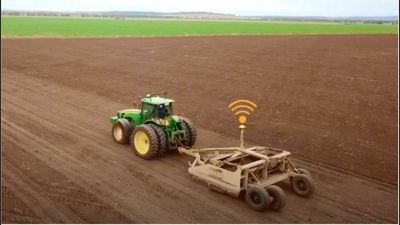
Compatible With These Machines & GPS

It does this 10 times per second, far faster than any human.
Watch full demo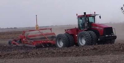
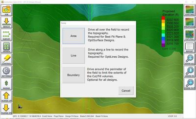
Precisely map your field topography by simply driving around your field, while AgGrade records elevation data every second, then automatically converts it to 3D surfaces and contour maps instantly. Easily record:
Fast and easy, with the lowest earthworks thanks to AI optimisation algorithms:
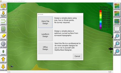
Automatically control blade height with hydraulic valves on any type of tractor and scraper to landform your fields perfectly and quickly.
Watch full demo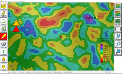
Save time, money and frustration while optimising your farm.
Out of the box, AgGrade has more compatibility, features and functionality than competing systems.
Our unique AI optimisation technology achieves cost savings of up to $500/acre through lower earthworks. This makes the program pay for itself in the first field.
“Instead of doing dirt work by laser and having to cut as much as 400 to 500 yd³/ac, in the same farm, we were lowering it to as little as 125 yd³/ac. Doing it at a much lower cost, with a lot less destruction to the topsoil of the farm.”

“It's been a great system for us. The improvements y'all have made have all been great.”

“Have the best tech support I have ever worked with. GREAT product and service!!”

“I can only say, so far, everything is perfect.”

“The results are far exceeding my expectations.”

Your purchase is 100% risk free.
We are so confident that you'll love AgGrade that if you're not happy for any reason, simply send all components back to us within 30 days in good condition and we'll happily refund your money.

AgGrade is AgEarth's in-field partner. Do detailed whole-farm designs at your desk in AgEarth, then take them to the cab in AgGrade.
Explore AgEarth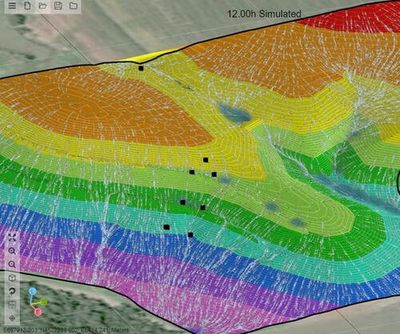
* AgGrade's older brother is OptiWorks, and its design engine comes from OptiSurface, which has optimised over 2,000,000 acres.
From the team behind OptiSurfacePricing depends on your setup. Fill in the form above and we'll email you pricing and call to talk it through.
AgGrade works with virtually any GPS receiver. It uses industry standard NMEA messages from the GPS, so your current system (provided it has the required accuracy) can probably be used. Common systems include CaseIH/Trimble (all smart antennas, plus FM750/1000 with RTK unlocks), John Deere (RTK is required, and the 6000 receiver has the fastest output rate [10 Hz] and accuracy), Outback (MAX/STX/S3/A320/A220 running RTK) and Ag Leader (all RTK receivers). There are other lower cost RTK receivers, but many need more knowledge to configure correctly and may not be as reliable or accurate.
Yes. AgGrade relies on accurate GPS elevation and position data, and is only as accurate as the incoming GPS messages. With low accuracy GPS your implement will move up and down randomly as you work. For the best vertical accuracy use a GNSS receiver on the rover and base station, with the base within 1 km (1/2 mile) of the operating machine. That should give you sub-inch vertical accuracy most of the time.
We designed AgGrade to be as simple as possible, but there may be times you need a little help. Your dealer should be your first line of support, and they can escalate if needed. If you ordered online or we shipped your system directly, call us on +1 870-340-2020 (USA) or 0405 686 425 (AUS), or email support@ag.zone.
The only measurement we need is the cutting edge-to-ground height in the transport position. We account for this when surveying.
AgGrade has a Nudge function for this. If you find yourself spinning out, hit Nudge Up to reduce the cutting depth for the current pass. The screen shows your final target height. On the next pass, Nudge Down. Repeat as many times as needed until you reach the final target height.
AgGrade runs on Microsoft Windows tablets.
Not yet. AgGrade runs on Windows tablets today, and iPad and Android versions are planned.
No. A data plan on your tablet is useful for support and for emailing surveys and designs to and from the office or third parties, but it isn't required.
Yes. We've designed everything to be easily moved in just a few minutes.
Yes. Survey the proposed path or area, then enter a minimum and maximum gradient. AgGrade computes an optimised profile or surface that can save you up to 80% in earth moving compared to constant grade designs.
Yes. You can design planes with single or dual slopes in the cab, with or without a field survey.
In theory yes, but keep in mind there's no slope/pitch sensor, so pitch plows could over-pitch and/or go off grade.
Yes. You can create ditch designs on curved or straight paths.
AgGrade includes a number of design types you can calculate in the cab. For more complicated designs use AgEarth in the office, which gives you finer control and detail. Contact us if your scenario isn't listed above, and odds are we can accommodate you.
Still have questions? Call us on +1 870-340-2020 (USA) or 0405 686 425 (AUS) or email support@ag.zone.